A Non Directional Beacon (NDB) is a radio transmitter used in aviation as a navigational aid. Unlike directional systems like VOR or GPS, NDBs transmit radio signals in all directions with equal intensity. Pilots use NDBs to determine their position relative to the beacon by receiving its signals and interpreting the signal strength or bearing. NDBs are primarily used for aircraft navigation, especially in areas where other navigational aids may be unavailable or unreliable. They are particularly useful for providing navigational guidance during instrument flight conditions or when flying over remote areas.
How Non Directional Beacon (NDB) Works?
A Non-Directional Beacon (NDB) works by transmitting radio signals in all directions with equal intensity. These signals are typically transmitted on medium or low-frequency bands.
Pilots use NDBs for navigation by tuning their aircraft’s radio receivers to the frequency of a specific NDB. The receiver detects the signal strength and/or phase of the received signal, allowing the pilot to determine the direction of the NDB relative to the aircraft. By comparing the signal strength or phase from multiple NDBs, pilots can triangulate their position or follow predetermined routes known as airways.
Navigating with NDBs requires pilots to interpret the signal strength or bearing displayed on their cockpit instruments, such as ADF (Automatic Direction Finder) receivers. The relative strength of the signal or the direction from which it is received provides information about the aircraft’s position relative to the NDB.
Non Directional Beacon Aviation
A Non-Directional Beacon (NDB) is a ground-based radio transmitter used by aircraft for navigation. NDB signals are affected more by weather and terrain compared to other navigation aids.
Using NDB navigation involves two main components: the Automatic Direction Finder (ADF) on the aircraft and the NDB transmitter on the ground. The ADF detects the direction of the NDB signal relative to the aircraft and displays it on a cockpit instrument called a Radio Magnetic Indicator (RMI). This helps pilots easily determine if they are heading towards or away from the NDB station and make course corrections accordingly.

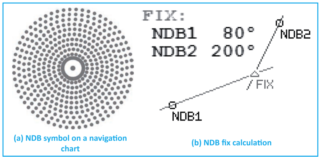
NDBs are crucial for defining air routes and fixes in the sky, allowing aircraft to navigate safely. In the past, flight routes relied heavily on NDB and VOR stations. On navigation charts, NDBs are represented by specific symbols.
With the advent of RNAV (Area Navigation), fixes can be calculated using information from two NDBs. By extending lines through known reference points until they intersect, new fixes or waypoints are determined, expanding the network of routes and enhancing the system’s capacity and efficiency.
Now, let’s discuss navigational aids that use spatial modulation:
- VOR (VHF Omnidirectional Radio Range): This system emits signals in all directions and helps aircraft determine their bearings relative to the VOR station. It’s a key tool for air navigation.
- ILS (Instrument Landing System): ILS assists aircraft during the landing phase, providing precise guidance for pilots to align with the runway and descend safely. It’s essential for ensuring accurate landings, especially in adverse weather conditions.